Chains and Tapes
Pocket tapes for small measurements, plus measuring wheels, Nyclad tapes and fiberglass tape measures for longer distances.
Fast, accurate support for land subdivision, cadastral surveys, beacon re-establishment, topographical mapping, title deed conveyancing and survey equipment hire.
Using highly specialized digital equipment to deliver accurate, precise measurements for every project — from single plots to large-scale infrastructure.

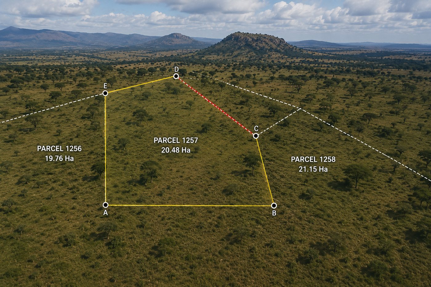
Cadastral surveys, land subdivision or partition, mutation processing, new grant surveys, amalgamation, land adjudication, wayleave and easement surveys across Kenya.
Enquire Now
We identify and map terrain, levels and ground features including trees, walkways, manholes and structures, producing precision base maps for design and construction.
Enquire Now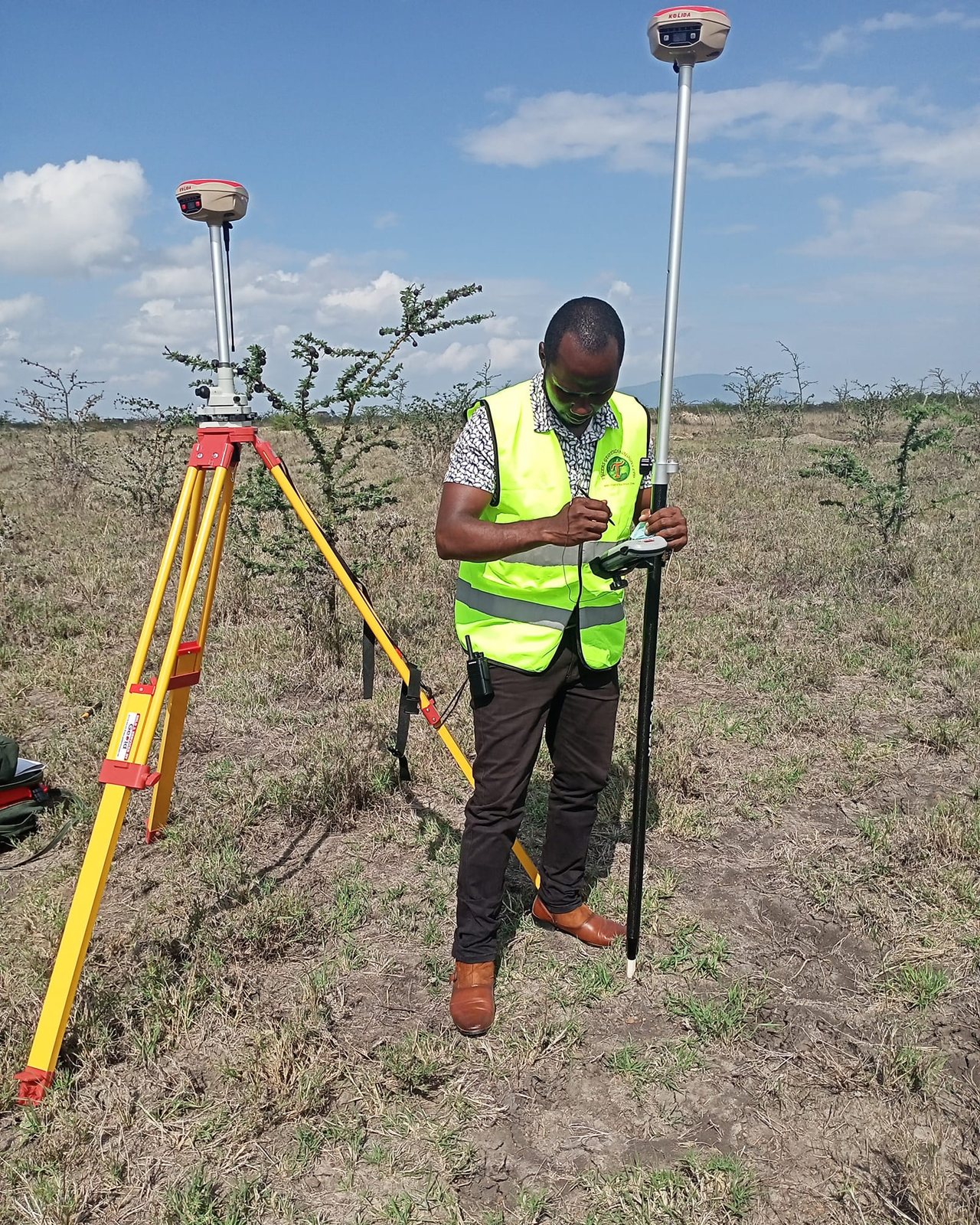
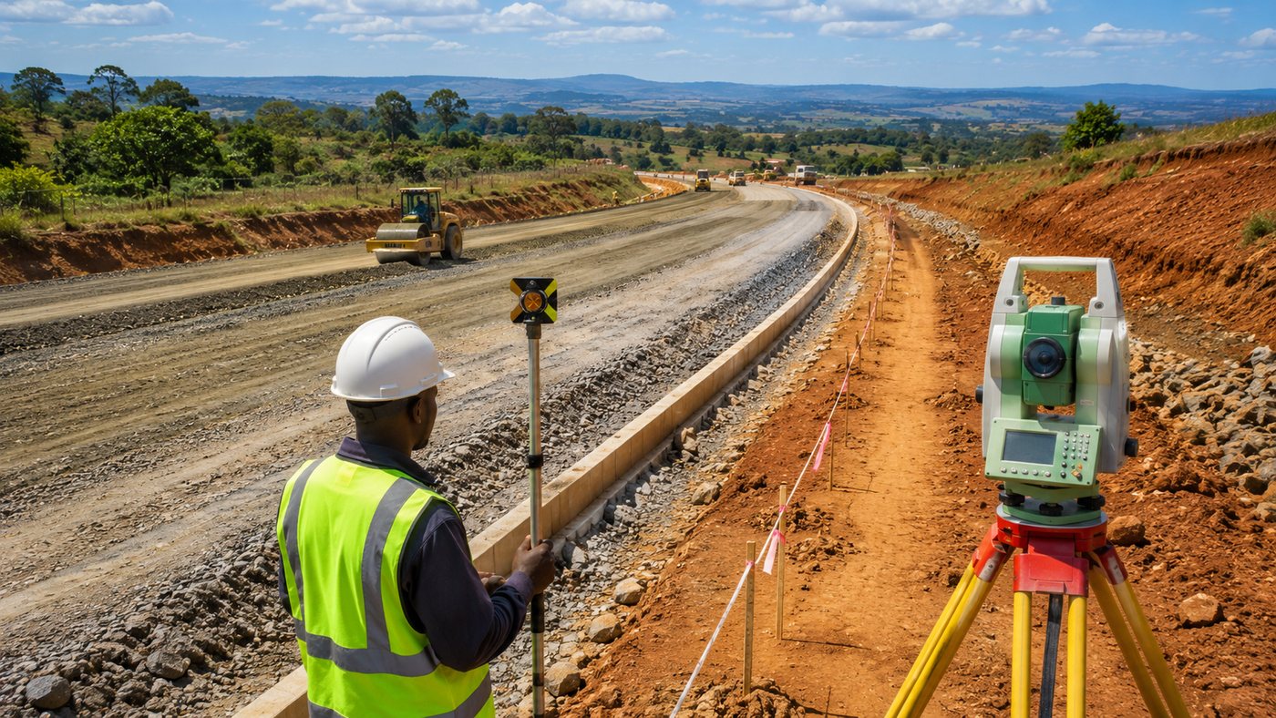
Precise positioning for roads, buildings, bridges and infrastructure. We provide setting out surveys and re-establishment surveys for civil engineers and contractors.
Enquire Now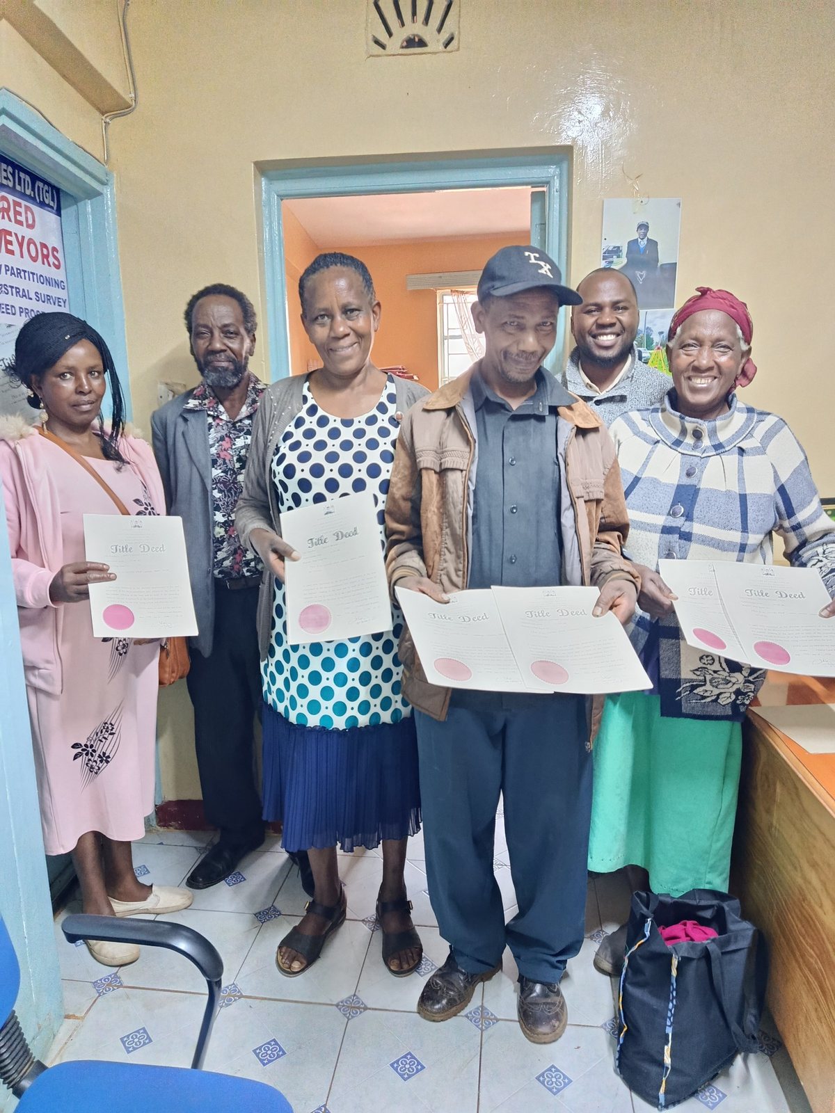
Verify ownership, boundaries and encumbrances before purchasing or developing land. We advise on the status of land ownership and any rights, restrictions or interests in property.
Enquire Now
Title deed conveyancing support, land transfer documentation, land searches and registry follow-up for buyers, sellers, advocates and property developers.
Enquire NowLand area confirmation, boundary checks and beacon re-establishment to help owners confirm parcel extent, recover lost marks and resolve boundary uncertainty.
Enquire Now
Digital mapping, spatial analysis and GIS data solutions for government agencies, developers and conveyancing firms. We deliver accurate geospatial data to support informed land decisions.
Enquire Now
Surveys for apartments, complexes and sectional titles — providing clear delineation of individual units and common areas with precise documentation for legal registration.
Enquire Now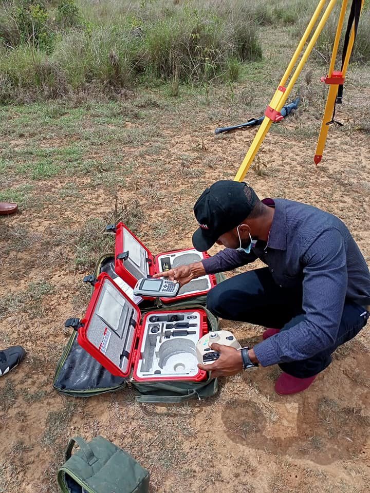
Modern survey instruments available for hire, including total stations, digital levels and GNSS/GPS systems, with technical and logistical support nationwide.
View Hire DetailsShare your land parcel details, title deed number and the survey type needed. We assess and confirm feasibility.
We conduct an official title deed search at the local land registry and obtain a Registry Index Map (RIM) from Survey of Kenya.
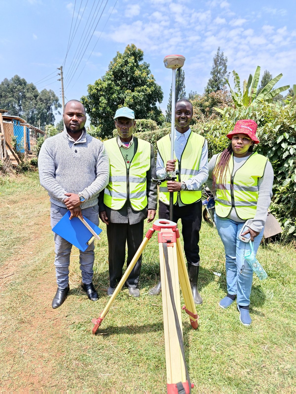
Our team visits the site with GNSS/GPS equipment for precise measurements, boundary demarcation and data collection.
Receive certified survey plans, adjudication maps and all documentation required for title registration and legal purposes.
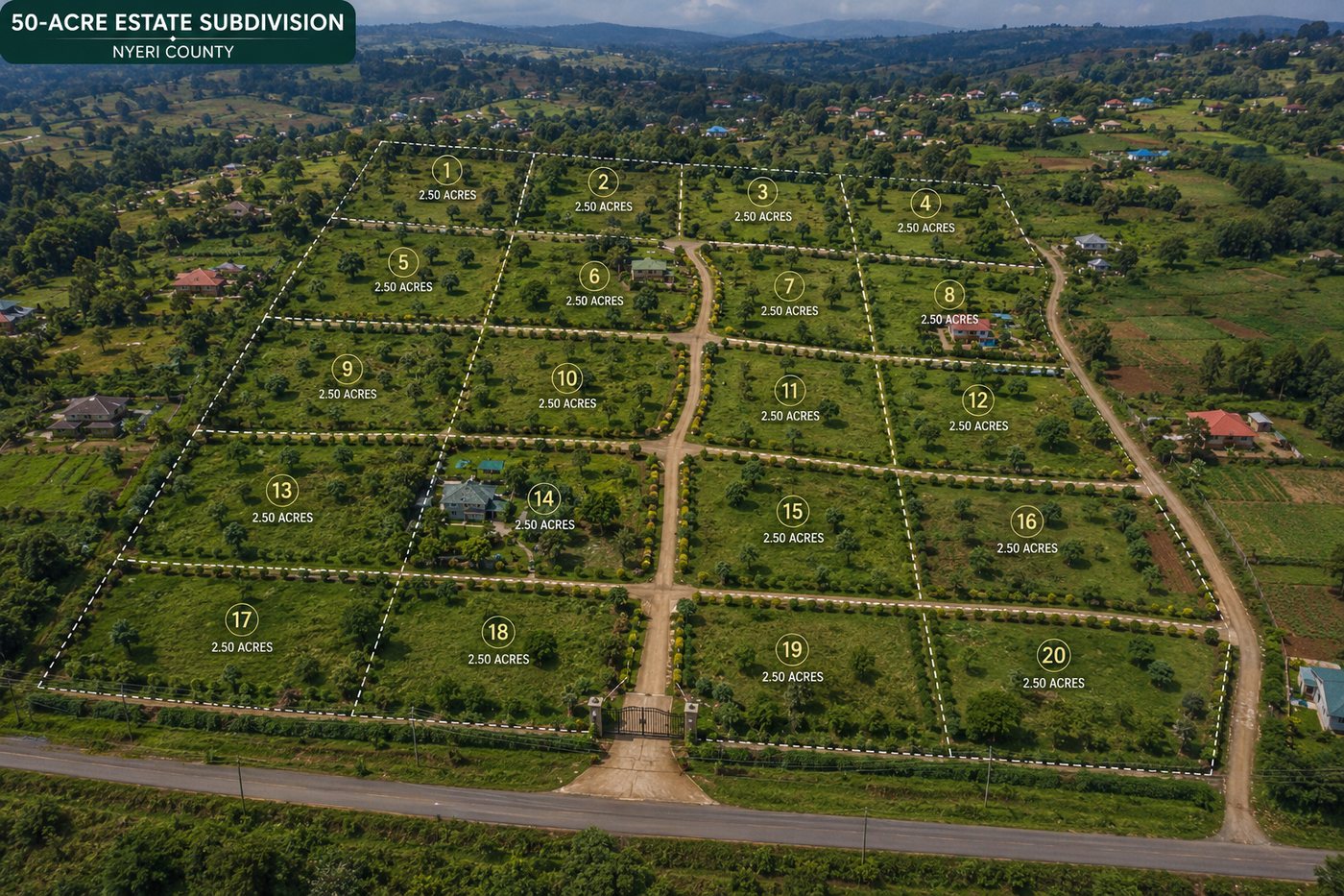
Nyeri County
Nakuru County

Nairobi
Laikipia County

We have a full range of advanced hardware and software for positioning and measuring, backed by technical and logistical support. Some available equipment includes:
Pocket tapes for small measurements, plus measuring wheels, Nyclad tapes and fiberglass tape measures for longer distances.
Compasses for orientation in unfamiliar terrain and clinometers for checking slope angle, elevation and gradient.
Prism systems and reflectors for control points, pole mounting and improved EDM measurement accuracy.
Handheld, optical and digital levels used with rods or tripods to read elevation and compare height differences.
Angle-measuring instruments for horizontal and vertical control, including precise theodolites for demanding survey work.
Stable mounting accessories for prisms, lasers, levels and other instruments where steady readings matter.
Receivers, antennas and supporting software for high-accuracy positioning, from handheld units to integrated GNSS packages.
Tylers Geotechnologies Ltd is a professional land surveying and geospatial firm based in Nyeri, Kenya. Led by Surveyor E. Ndung'u Kimani — a Member of the Institution of Surveyors of Kenya (MISK) and Licensed Estate Agent — we serve conveyancing firms, estate developers, architects, civil engineers, government agencies, and individual landowners.
Precision first. We use highly specialized digital equipment and rigorous methodology to achieve accurate and precise measurements for every task.
Kenya expertise. Deep knowledge of Kenya's land laws, title processes, and Survey of Kenya requirements — we navigate the system so you don't have to.
Pan-African reach. While headquartered in Nyeri, we offer land surveying services across Kenya and Africa at large.
"TGL handled our estate subdivision in Nyeri with exceptional precision. The boundary demarcation was completed on time and all documentation was in order for title transfer."
"As a conveyancing firm, accuracy and speed are everything. Tylers consistently delivers precise title and due diligence surveys that we trust to protect our clients' interests."
"The topographic mapping TGL produced was the foundation for our entire road design. Their GIS output integrated seamlessly with our engineering software — superb quality."
Answers to the most common questions about land surveys, title processes and land ownership in Kenya.